ROAM turns your phone or tablet into a handheld GPS with extensive outdoor map data! Find new places to recreate using the most complete public lands & open spaces maps ever created. Going out of cellular data coverage? No problem! Your GPS works even without cell service and you can save your maps and markups for offline use.
•Turn Your smartphone or tablet into a powerful handheld GPS
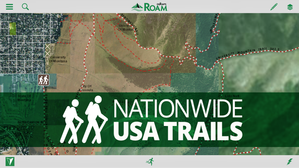
•Discover new trails by browsing the most comprehensive nationwide trails map ever created
•Find Open Space with onXmaps’ accurate Public Lands data
•We’ve combined all your paper maps into a much more customizable digital map suite
•Turn Map Layers and Basemaps on and off to customize your maps for your favorite activity
•See Recreation Access Areas and Water Sports Access Points
•Switch between comprehensive Base maps including Aerial imagery, 24K topo, and Hybrids
•Save Maps for Offline Use when out of cell coverage
•Create Geotagged Photo Waypoints and Customized Waypoints
•Auto-Sync and Share Waypoints, Tracks, Measurements, and Stats with your Team and between your devices
FREE TRIAL
While the App and many of it’s features are free. You will start a free Roam Nationwide and State Private Parcels trial when you install the App. This allows you to try our full app for 7 days.
ROAM APP FEATURES
▶ MAP DATA FEATURES
From mountain biking to kayaking, from the summit to the sea, if you love outdoor adventure - WE GUARANTEE there is time-saving map data in the ROAM app for you. Here is just a preview of the map options that ROAM puts right at your fingertips.
•Public Lands: Nationwide Federal and State (the most accurate and complete nationwide dataset ever created)
•City and County Open Space
•Trail and Trailhead locations, names and numbers
•Geographic and Recreational Point of Interests
•Water Data
•Weather and Radar
•Campgrounds and secluded Campsites
•Ski runs and lifts
•National Park Service Visitor maps
•National Forest Visitor Maps (save thousands $$$ on paper maps!)
•Motor Vehicle Roads and Trails (MVUM) displaying National Forest System (NFS) Routes (roads and trails) open to motorized travel
•Nationwide USFS Roads
•Nationwide USFS Trails and Wilderness
•USGS Gage Stations
•USGS Snotel (snowfall measurements)
•Wildfire Historic Perimeters
•Active Fires
•Private Landowner Names with Property Boundaries
•And much more!
▶ BASEMAPS
•USGS Topo (Quads)
•Aerial Imagery
•Imagery + Topo Hybrid
•OpenStreetMap
•World Topo
•World Imagery
•World Streets
•USA Topo Maps
•Ocean BaseMap
▶ GPS Functionality Right on Your Phone or Tablet
•GPS Location
•Mark Waypoints
•Tracks
•Compass Mode
•View elevation profiles
•Backtrack function to make sure you can always make it back to the vehicle safely
▶ TRACKING FUNCTIONALITY
•Active track on/off
•Track elevation profile
▶ MARKUPS AND DRAW TOOLS
•Place Points on the map
•Geotag Photos
•Use Custom ROAM Waypoint Symbols
•Draw Lines
•Draw Shapes
▶ MULTIPLE DEVICES (my.onxmaps Cloud sync):
•ROAM anywhere! One account gives you access across multiple devices
•2 devices - Use on your phone and tablet
•New phone? No problem. Simply log in to your account and access all your map content that is automatically saved to your account
•Your tracks, photos, waypoints and maps are automatically synced to all your devices
•Waypoints are automatically saved to the cloud. No more risk of losing your valuable waypoints if you lose your GPS or change phones
▶ SHARE VIA SOCIAL, TEXT, OR EMAIL
•Tracks
•Markups
▶ MEASURE TOOLS
•Distances
•Perimeters
•Areas
▶ SEARCH
•Search for nearby places
•Points of Interest
•Landowner Names
▶ AUTOMATIC MAP UPDATES
•The newest map data is automatically streamed into your device with no cumbersome update process
▶ ‘USE SAVED MAPS’ MODE
•Forces the app to use your saved maps when in areas of low cell signal
•Saves on battery life
Note: As with all mapping apps, continued use of GPS running in the background can dramatically decrease battery life.
We do not host ROAM GPS:Recreation Maps&Tools on our servers. We did not scan it for viruses, adware, spyware or other type of malware. This app is hosted by Galad and passed their terms and conditions to be listed there. We recommend caution when installing it.
The APK Download link for ROAM GPS:Recreation Maps&Tools is provided to you by apps112.com without any warranties, representations or guarantees of any kind, so access it at your own risk.
If you have questions regarding this particular app contact the publisher directly. For questions about the functionalities of apps112.com contact us.

|
| ||||
| Downloads: 9 | ||||
| Updated At: 2024-04-23 11:10:25 | ||||
| Publisher: onXmaps | ||||
| Operating System: Android | ||||
| License Type: Free |